
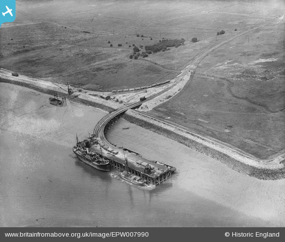
EPW007990 ENGLAND (1922). A jetty on the north bank of the River Thames, Dagenham, 1922
© Copyright OpenStreetMap contributors and licensed by the OpenStreetMap Foundation. 2026. Cartography is licensed as CC BY-SA.
Nearby Images (3)
EPW007990

EPW007991

EPW036784

Details
| Title | [EPW007990] A jetty on the north bank of the River Thames, Dagenham, 1922 |
| Reference | EPW007990 |
| Date | May-1922 |
| Link | |
| Place name | DAGENHAM |
| Parish | |
| District | |
| Country | ENGLAND |
| Easting / Northing | 547943, 182172 |
| Longitude / Latitude | 0.13253500547653, 51.518585777227 |
| National Grid Reference | TQ479822 |
Pins
User Comment Contributions
A Jetty by Horse Shoe Corner and the Dagenham Marshes, Dagenham, same location as EPW007991 and EPW036784 |

Class31 |
Monday 1st of July 2013 12:54:13 PM |
Thanks for finding this one - I'm always surprised at just how late much of the development of this area is. We'll update the catalogue, and post the new data here in due course. Yours, Katy Britain from Above Cataloguing Team Leader |
Katy Whitaker |
Monday 1st of July 2013 12:54:13 PM |
The jetty and railway do not appear on maps dated 1921-1938 but do appear on maps dated 1940-1950 at 548000,182100. The jetty was extended between this picture (1922) and in EPW036784 in 1931. |

John |
Saturday 11th of May 2013 09:23:14 PM |
Eureka |
Class31 |
Thursday 2nd of May 2013 11:49:33 PM |