
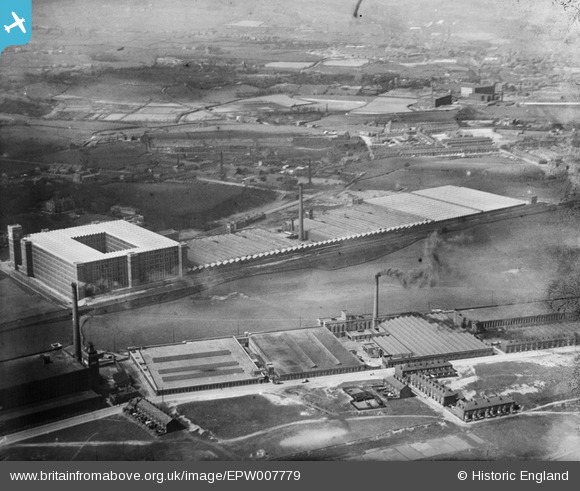
EPW007779 ENGLAND (1922). The Dunlop and Ensor Mills, Rochdale, 1922
© Copyright OpenStreetMap contributors and licensed by the OpenStreetMap Foundation. 2025. Cartography is licensed as CC BY-SA.
Nearby Images (5)
EPW007779

EPW007777

EPW007778

EPW007780

EPW016706

Details
| Title | [EPW007779] The Dunlop and Ensor Mills, Rochdale, 1922 |
| Reference | EPW007779 |
| Date | 13-May-1922 |
| Link | |
| Place name | ROCHDALE |
| Parish | |
| District | |
| Country | ENGLAND |
| Easting / Northing | 388679, 411427 |
| Longitude / Latitude | -2.1710860076479, 53.599051433658 |
| National Grid Reference | SD887114 |
Pins
 HILLARY |
Saturday 16th of May 2015 03:02:45 PM |