
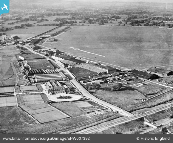
EPW007392 ENGLAND (1921). London Country Club, Aerodrome Road and Hendon Aerodrome, Colindale, from the south-east, 1921. This image has been produced from a copy-negative.
© Copyright OpenStreetMap contributors and licensed by the OpenStreetMap Foundation. 2026. Cartography is licensed as CC BY-SA.
Nearby Images (24)
EPW007392

EPW009684

EPW002011

EPW002007

EPW000012

EPW002010

EPW000014

EPW000009

EPW000013

EPW006859

EPW000010

EPW000001

EPW002008A

EPW002008

EPW016608

EPW000006

EPW006132

EPW016611

EPW016610

EPW016606

EPW016609

EPW016605

EPW016612

EPW016607

Details
| Title | [EPW007392] London Country Club, Aerodrome Road and Hendon Aerodrome, Colindale, from the south-east, 1921. This image has been produced from a copy-negative. |
| Reference | EPW007392 |
| Date | 28-October-1921 |
| Link | |
| Place name | COLINDALE |
| Parish | |
| District | |
| Country | ENGLAND |
| Easting / Northing | 522113, 189782 |
| Longitude / Latitude | -0.23694071827822, 51.593161914654 |
| National Grid Reference | TQ221898 |
Pins

The Laird |
Sunday 19th of August 2018 03:07:55 PM | |
|
The Laird |
Thursday 4th of January 2018 06:06:04 PM | |
|
ken |
Thursday 11th of June 2015 03:22:28 PM | |
|
Mark Amies |
Sunday 25th of January 2015 10:38:39 PM | |
|
clive |
Friday 5th of December 2014 01:01:17 AM |