
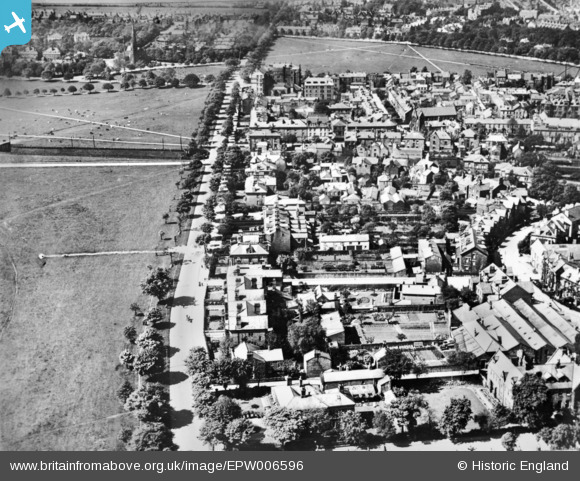
EPW006596 ENGLAND (1921). York Place and environs, Harrogate, 1921. This image has been produced from a copy-negative.
© Copyright OpenStreetMap contributors and licensed by the OpenStreetMap Foundation. 2026. Cartography is licensed as CC BY-SA.
Nearby Images (2)
EPW006596

EPW015797

Details
| Title | [EPW006596] York Place and environs, Harrogate, 1921. This image has been produced from a copy-negative. |
| Reference | EPW006596 |
| Date | June-1921 |
| Link | |
| Place name | HARROGATE |
| Parish | |
| District | |
| Country | ENGLAND |
| Easting / Northing | 430714, 454956 |
| Longitude / Latitude | -1.5315089560477, 53.989543654847 |
| National Grid Reference | SE307550 |
Pins

John Wass |
Monday 6th of April 2015 08:50:23 PM |