
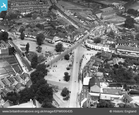
EPW006435 ENGLAND (1921). Upper Green, Mitcham, 1921. This image has been produced from a print.
© Copyright OpenStreetMap contributors and licensed by the OpenStreetMap Foundation. 2026. Cartography is licensed as CC BY-SA.
Nearby Images (9)
EPW006435

EPW011769

EPW055287

EPW055284

EAW047587

EAW047586

EAW047588

EAW047585

EAW047590

Details
| Title | [EPW006435] Upper Green, Mitcham, 1921. This image has been produced from a print. |
| Reference | EPW006435 |
| Date | 1-June-1921 |
| Link | |
| Place name | MITCHAM |
| Parish | |
| District | |
| Country | ENGLAND |
| Easting / Northing | 527805, 169029 |
| Longitude / Latitude | -0.16232397439167, 51.405374104954 |
| National Grid Reference | TQ278690 |
Pins

Nowy Paul |
Saturday 24th of February 2018 02:43:34 PM | |
|
Wade |
Monday 3rd of November 2014 07:35:12 AM | |
|
Wade |
Monday 3rd of November 2014 07:31:16 AM | |
|
Wade |
Sunday 2nd of November 2014 11:08:30 PM | |
|
Wade |
Sunday 2nd of November 2014 10:42:46 PM | |
|
Wade |
Sunday 2nd of November 2014 10:24:00 PM |