
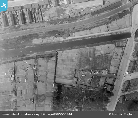
EPW006344 ENGLAND (1921). Allotments between the Beverley and Barmston Drain and Sculcoates Cemetery, Sculcoates, 1921
© Copyright OpenStreetMap contributors and licensed by the OpenStreetMap Foundation. 2026. Cartography is licensed as CC BY-SA.
Nearby Images (8)
EPW006344

EAW030289

EPW006337

EPW006345

EPW006343

EAW030288

EPW042059

EPW006348

Details
| Title | [EPW006344] Allotments between the Beverley and Barmston Drain and Sculcoates Cemetery, Sculcoates, 1921 |
| Reference | EPW006344 |
| Date | May-1921 |
| Link | |
| Place name | SCULCOATES |
| Parish | |
| District | |
| Country | ENGLAND |
| Easting / Northing | 509366, 430682 |
| Longitude / Latitude | -0.34081906943656, 53.760778257379 |
| National Grid Reference | TA094307 |
Pins

John Wass |
Saturday 2nd of September 2017 11:23:58 AM | |
|
John Wass |
Sunday 23rd of August 2015 08:36:49 PM | |
|
John Wass |
Sunday 23rd of August 2015 08:33:21 PM |