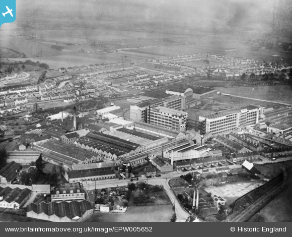
EPW005652 ENGLAND (1921). The Vickers Crayford Works and environs, Crayford, 1921. This image has been produced from a copy-negative.
© Copyright OpenStreetMap contributors and licensed by the OpenStreetMap Foundation. 2026. Cartography is licensed as CC BY-SA.
Details
| Title | [EPW005652] The Vickers Crayford Works and environs, Crayford, 1921. This image has been produced from a copy-negative. |
| Reference | EPW005652 |
| Date | March-1921 |
| Link | |
| Place name | CRAYFORD |
| Parish | |
| District | |
| Country | ENGLAND |
| Easting / Northing | 551827, 174799 |
| Longitude / Latitude | 0.18530717481123, 51.451301460652 |
| National Grid Reference | TQ518748 |
Pins

Chiltern View |
Saturday 13th of August 2016 01:09:32 PM | |

Tom Burnham |
Wednesday 6th of January 2016 10:00:57 PM |


![[EPW005652] The Vickers Crayford Works and environs, Crayford, 1921. This image has been produced from a copy-negative.](http://britainfromabove.org.uk/sites/all/libraries/aerofilms-images/public/100x100/EPW/005/EPW005652.jpg)
![[EPW028339] The Vickers Crayford Works and environs, Crayford, 1929](http://britainfromabove.org.uk/sites/all/libraries/aerofilms-images/public/100x100/EPW/028/EPW028339.jpg)
![[EPW028338] Green Walk and Crayford Way, Crayford, 1929](http://britainfromabove.org.uk/sites/all/libraries/aerofilms-images/public/100x100/EPW/028/EPW028338.jpg)