
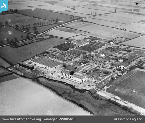
EPW005613 ENGLAND (1921). The Sterling Works, Dagenham, 1921
© Copyright OpenStreetMap contributors and licensed by the OpenStreetMap Foundation. 2026. Cartography is licensed as CC BY-SA.
Nearby Images (22)
EPW005613

EPW005610

EPW008527

EPW008524

EPW008528

EPW008523A

EPW008521

EPW008520

EPW005615

EPW056253

EPW008523

EPW056252

EPW056255

EPW056251

EPW056254

EPW005612

EPW005611

EPW008522

EPW056256

EAW040652

EAW040649

EAW040650

Details
| Title | [EPW005613] The Sterling Works, Dagenham, 1921 |
| Reference | EPW005613 |
| Date | March-1921 |
| Link | |
| Place name | DAGENHAM |
| Parish | |
| District | |
| Country | ENGLAND |
| Easting / Northing | 549831, 185624 |
| Longitude / Latitude | 0.16119818278161, 51.549107944232 |
| National Grid Reference | TQ498856 |
Pins
Be the first to add a comment to this image!