
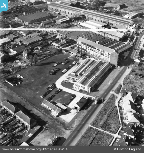
EAW040650 ENGLAND (1951). The Ford Motor Co Rainham Works, Dagenham, 1951. This image has been produced from a print marked by Aerofilms Ltd for photo editing.
© Copyright OpenStreetMap contributors and licensed by the OpenStreetMap Foundation. 2026. Cartography is licensed as CC BY-SA.
Nearby Images (22)
EAW040650

EAW040649

EPW008522

EAW040652

EPW005615

EPW005612

EPW008520

EPW008523A

EPW008524

EPW008528

EPW008527

EPW008523

EPW005610

EPW008521

EPW005613

EPW005611

EPW056253

EPW056256

EPW056254

EPW056255

EPW056252

EPW056251

Details
| Title | [EAW040650] The Ford Motor Co Rainham Works, Dagenham, 1951. This image has been produced from a print marked by Aerofilms Ltd for photo editing. |
| Reference | EAW040650 |
| Date | 12-October-1951 |
| Link | |
| Place name | DAGENHAM |
| Parish | |
| District | |
| Country | ENGLAND |
| Easting / Northing | 549995, 185545 |
| Longitude / Latitude | 0.1635282563942, 51.548354470974 |
| National Grid Reference | TQ500855 |
Pins

Matt Aldred edob.mattaldred.com |
Sunday 3rd of May 2020 04:57:47 PM |