
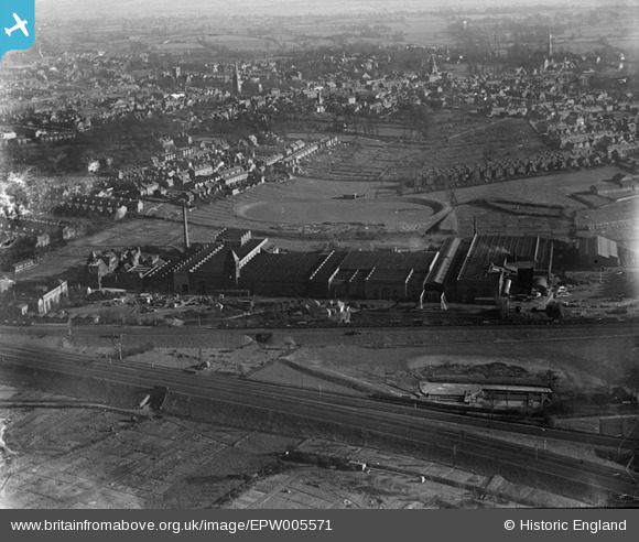
EPW005571 ENGLAND (1921). The Victoria Engineering Works, Rugby, from the north-west, 1921
© Copyright OpenStreetMap contributors and licensed by the OpenStreetMap Foundation. 2026. Cartography is licensed as CC BY-SA.
Nearby Images (14)
EPW005571

EPW005572

EPW005570

EPW033942

EPW010527

EPW033952

EPW033944

EPW033951

EPW033946

EPW033949

EPW033950

EPW033948

EPW033947

EPW033953

Details
| Title | [EPW005571] The Victoria Engineering Works, Rugby, from the north-west, 1921 |
| Reference | EPW005571 |
| Date | March-1921 |
| Link | |
| Place name | RUGBY |
| Parish | |
| District | |
| Country | ENGLAND |
| Easting / Northing | 449708, 276025 |
| Longitude / Latitude | -1.2696584802029, 52.379621963502 |
| National Grid Reference | SP497760 |
Pins

PeteW |
Wednesday 22nd of January 2020 10:22:18 AM | |
|
Neville Taylor |
Sunday 23rd of September 2012 02:57:36 PM | |
|
Neville Taylor |
Sunday 23rd of September 2012 02:56:52 PM | |
|
Neville Taylor |
Sunday 23rd of September 2012 02:56:24 PM |