
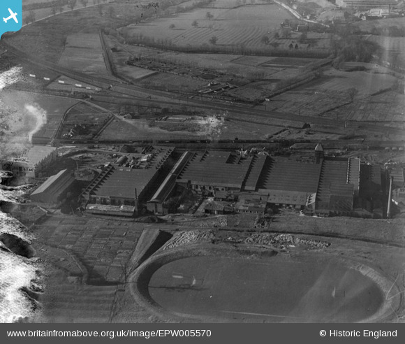
EPW005570 ENGLAND (1921). The Victoria Engineering Works, Rugby, 1921
© Copyright OpenStreetMap contributors and licensed by the OpenStreetMap Foundation. 2026. Cartography is licensed as CC BY-SA.
Nearby Images (15)
EPW005570

EPW033951

EPW033949

EPW033944

EPW005572

EPW010527

EPW033946

EPW033948

EPW033947

EPW033942

EPW033950

EPW005571

EPW033954

EPW033952

EPW033953

Details
| Title | [EPW005570] The Victoria Engineering Works, Rugby, 1921 |
| Reference | EPW005570 |
| Date | March-1921 |
| Link | |
| Place name | RUGBY |
| Parish | |
| District | |
| Country | ENGLAND |
| Easting / Northing | 449736, 275885 |
| Longitude / Latitude | -1.2692679010147, 52.378360760898 |
| National Grid Reference | SP497759 |
Pins
Be the first to add a comment to this image!