
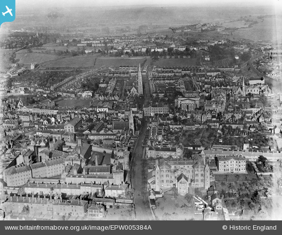
EPW005384A ENGLAND (1921). Castle Street and environs, Worcester, from the south-west, 1921
© Copyright OpenStreetMap contributors and licensed by the OpenStreetMap Foundation. 2026. Cartography is licensed as CC BY-SA.
Nearby Images (5)
EPW005384A

EPW000200

EPW001303

EPW000210

EPW001302

Details
| Title | [EPW005384A] Castle Street and environs, Worcester, from the south-west, 1921 |
| Reference | EPW005384A |
| Date | March-1921 |
| Link | |
| Place name | WORCESTER |
| Parish | |
| District | |
| Country | ENGLAND |
| Easting / Northing | 384689, 255350 |
| Longitude / Latitude | -2.2240282519643, 52.195770471734 |
| National Grid Reference | SO847554 |
Pins

Wren |
Saturday 12th of October 2013 08:04:54 PM | |
|
Wren |
Saturday 12th of October 2013 08:02:43 PM | |
 |
Red Baron |
Sunday 4th of August 2013 07:34:17 AM |