
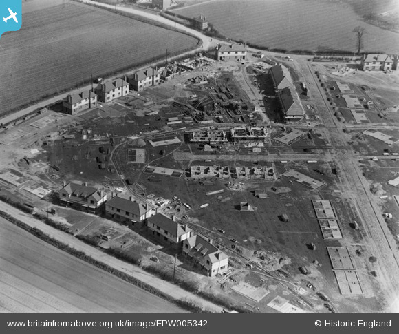
EPW005342 ENGLAND (1921). A new housing estate under construction at Crossways, Dagenham, 1921
© Copyright OpenStreetMap contributors and licensed by the OpenStreetMap Foundation. 2026. Cartography is licensed as CC BY-SA.
Nearby Images (10)
EPW005342

EPW006559

EPW006557

EPW005339

EPW005340

EPW006556

EPW005343

EPW005338

EPW005341

EPW006558

Details
| Title | [EPW005342] A new housing estate under construction at Crossways, Dagenham, 1921 |
| Reference | EPW005342 |
| Date | January-1921 |
| Link | |
| Place name | DAGENHAM |
| Parish | |
| District | |
| Country | ENGLAND |
| Easting / Northing | 549179, 183764 |
| Longitude / Latitude | 0.15101224610899, 51.532566578339 |
| National Grid Reference | TQ492838 |
Pins
User Comment Contributions

The detail on this photo is amazing. There are houses at every stage, from mere foundations to just completed. Zoom in to look at the scaffolding! |

Whittocks |
Wednesday 30th of May 2012 10:58:49 PM |