
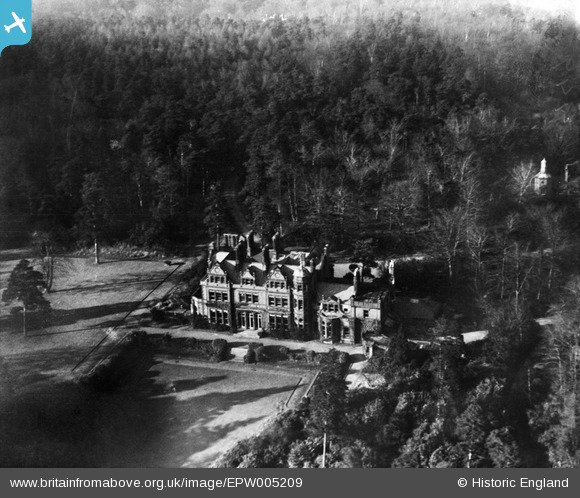
EPW005209 ENGLAND (1921). Ballards, Addington Hills, 1921
© Copyright OpenStreetMap contributors and licensed by the OpenStreetMap Foundation. 2025. Cartography is licensed as CC BY-SA.
Nearby Images (14)
EPW005209

EPW005208

EPW005207

EPW005206

EPW047037
, Croydon, 1935. This image has been marked by Aerofilms Ltd for photo editing.")
EPW005205

EPW046867

EPW046864

EPW046866

EPW046869

EPW046865

EPW046863

EPW047039
, Croydon, 1935")
EPW047038
 and environs, Croydon, 1935. This image has been marked by Aerofilms Ltd for photo editing.")
Details
| Title | [EPW005209] Ballards, Addington Hills, 1921 |
| Reference | EPW005209 |
| Date | 21-January-1921 |
| Link | |
| Place name | ADDINGTON HILLS |
| Parish | |
| District | |
| Country | ENGLAND |
| Easting / Northing | 534859, 163916 |
| Longitude / Latitude | -0.062898553034393, 51.357787097689 |
| National Grid Reference | TQ349639 |
Pins
Be the first to add a comment to this image!