
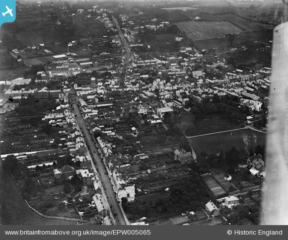
EPW005065 ENGLAND (1920). General view of the town centre, Leominster, 1920
© Copyright OpenStreetMap contributors and licensed by the OpenStreetMap Foundation. 2025. Cartography is licensed as CC BY-SA.
Nearby Images (5)
EPW005065

EPW006998

EPW006996

EPW006997

EPW005064

Details
| Title | [EPW005065] General view of the town centre, Leominster, 1920 |
| Reference | EPW005065 |
| Date | September-1920 |
| Link | |
| Place name | LEOMINSTER |
| Parish | LEOMINSTER |
| District | |
| Country | ENGLAND |
| Easting / Northing | 349737, 258997 |
| Longitude / Latitude | -2.7359525200202, 52.22648051429 |
| National Grid Reference | SO497590 |
Pins

Molly |
Saturday 23rd of August 2014 09:05:28 AM |