
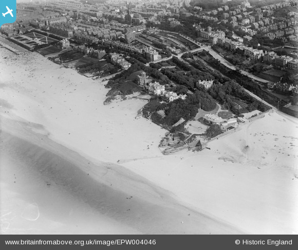
EPW004046 ENGLAND (1920). Wellington Road and environs, New Brighton, 1920
© Copyright OpenStreetMap contributors and licensed by the OpenStreetMap Foundation. 2026. Cartography is licensed as CC BY-SA.
Nearby Images (4)
EPW004046

EPW045204

EPW045208

EPW004049A

Details
| Title | [EPW004046] Wellington Road and environs, New Brighton, 1920 |
| Reference | EPW004046 |
| Date | August-1920 |
| Link | |
| Place name | NEW BRIGHTON |
| Parish | |
| District | |
| Country | ENGLAND |
| Easting / Northing | 330057, 394059 |
| Longitude / Latitude | -3.0530233727625, 53.438404205267 |
| National Grid Reference | SJ301941 |
Pins

marty99fred |
Monday 6th of November 2023 01:04:01 PM | |
|
ap493 |
Wednesday 23rd of August 2023 10:56:47 AM | |
|
ap493 |
Wednesday 23rd of August 2023 10:56:12 AM | |
|
Mercury |
Saturday 28th of November 2015 04:17:18 PM | |
|
Mercury |
Saturday 28th of November 2015 04:16:11 PM | |
|
KeithS |
Friday 18th of April 2014 09:49:37 PM |