
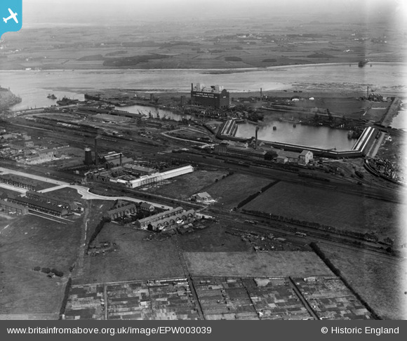
EPW003039 ENGLAND (1920). The Fish Dock and Wyre Dock, Fleetwood, 1920
© Copyright OpenStreetMap contributors and licensed by the OpenStreetMap Foundation. 2026. Cartography is licensed as CC BY-SA.
Nearby Images (12)
EPW003039

EPW038724

EPW038728

EPW038727

EPW038726

EPW038725

EPW038729

EAW023417

EPW038908

EPW038906

EPW038907

EPW038909

Details
| Title | [EPW003039] The Fish Dock and Wyre Dock, Fleetwood, 1920 |
| Reference | EPW003039 |
| Date | July-1920 |
| Link | |
| Place name | FLEETWOOD |
| Parish | FLEETWOOD |
| District | |
| Country | ENGLAND |
| Easting / Northing | 333183, 447015 |
| Longitude / Latitude | -3.0173734848298, 53.914767324373 |
| National Grid Reference | SD332470 |
Pins

stewpot |
Monday 30th of December 2019 07:11:42 PM |