
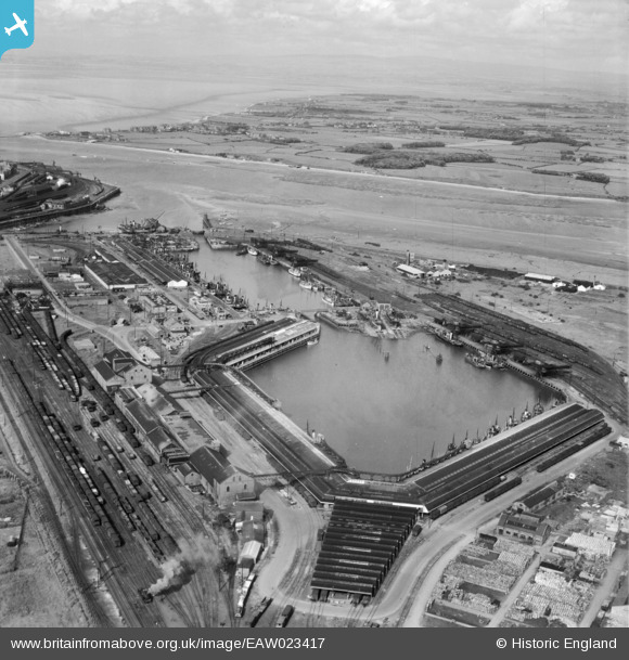
EAW023417 ENGLAND (1949). Fish Dock and Wyre Dock, Fleetwood, from the south-west, 1949
© Copyright OpenStreetMap contributors and licensed by the OpenStreetMap Foundation. 2026. Cartography is licensed as CC BY-SA.
Nearby Images (15)
EAW023417

EPW038729

EPW038726

EPW038725

EPW038909

EPW038724

EPW038906

EPW038907

EPW038727

EPW038728

EPW038908

EPW003039

EAW036976

EPW038730

EPW003037

Details
| Title | [EAW023417] Fish Dock and Wyre Dock, Fleetwood, from the south-west, 1949 |
| Reference | EAW023417 |
| Date | 25-May-1949 |
| Link | |
| Place name | FLEETWOOD |
| Parish | FLEETWOOD |
| District | |
| Country | ENGLAND |
| Easting / Northing | 333298, 446922 |
| Longitude / Latitude | -3.0156024846409, 53.913946313915 |
| National Grid Reference | SD333469 |
Pins

Matt Aldred edob.mattaldred.com |
Sunday 3rd of May 2026 07:31:14 PM | |

redmist |
Thursday 7th of April 2022 10:56:14 PM | |
PILLBOX (TYPE FW3/24): e47407 |
Matt Aldred edob.mattaldred.com |
Sunday 3rd of May 2026 07:26:33 PM |
|
MB |
Saturday 28th of December 2013 09:46:51 AM | |
|
MB |
Saturday 28th of December 2013 09:45:23 AM | |
|
MB |
Saturday 28th of December 2013 09:44:52 AM |