
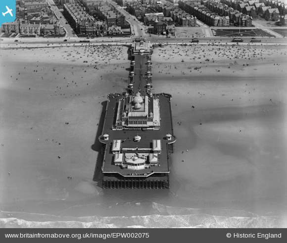
EPW002075 ENGLAND (1920). The Victoria Pier, Blackpool, 1920
© Copyright OpenStreetMap contributors and licensed by the OpenStreetMap Foundation. 2026. Cartography is licensed as CC BY-SA.
Nearby Images (10)
EPW002075

EPW002060

EPW038742

EPW038741

EPW029209

EPW038917

EAW020133

EAW023419

EAW026232

EPW012491

Details
| Title | [EPW002075] The Victoria Pier, Blackpool, 1920 |
| Reference | EPW002075 |
| Date | July-1920 |
| Link | |
| Place name | BLACKPOOL |
| Parish | |
| District | |
| Country | ENGLAND |
| Easting / Northing | 330281, 433758 |
| Longitude / Latitude | -3.0585406940041, 53.795239092805 |
| National Grid Reference | SD303338 |
Pins
Be the first to add a comment to this image!