
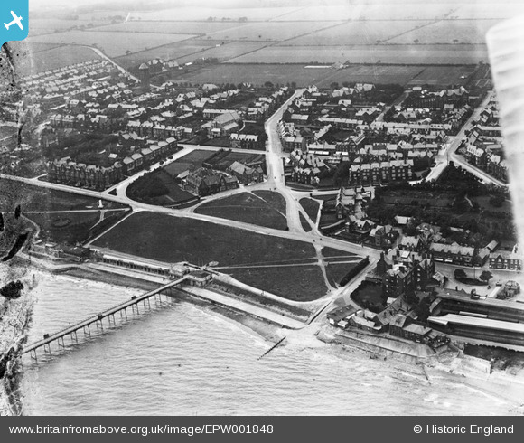
EPW001848 ENGLAND (1920). The Green, Hunstanton, 1920
© Copyright OpenStreetMap contributors and licensed by the OpenStreetMap Foundation. 2026. Cartography is licensed as CC BY-SA.
Nearby Images (11)
EPW001848

EPW021525

EPW021523

EPW001995

EPW021526

EPW021521

EPW000851

EPW021524

EAW050929

EPW001854

EAW050930

Details
| Title | [EPW001848] The Green, Hunstanton, 1920 |
| Reference | EPW001848 |
| Date | June-1920 |
| Link | |
| Place name | HUNSTANTON |
| Parish | HUNSTANTON |
| District | |
| Country | ENGLAND |
| Easting / Northing | 567275, 340944 |
| Longitude / Latitude | 0.48950950077154, 52.939467581344 |
| National Grid Reference | TF673409 |
Pins

totoro |
Thursday 19th of March 2015 07:38:13 PM | |
|
totoro |
Thursday 19th of March 2015 07:26:47 PM | |
|
totoro |
Thursday 19th of March 2015 07:23:15 PM | |
|
totoro |
Thursday 19th of March 2015 07:20:21 PM | |
|
totoro |
Thursday 19th of March 2015 07:19:31 PM | |

melgibbs |
Thursday 12th of March 2015 03:47:52 PM | |
|
melgibbs |
Wednesday 11th of March 2015 06:43:00 PM | |
|
melgibbs |
Saturday 15th of February 2014 04:33:20 PM |
User Comment Contributions

A prominent position, looking out to sea |
Lynda Tubbs |
Wednesday 20th of August 2014 01:58:08 PM |