
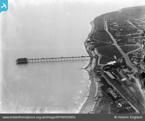
EPW000851 ENGLAND (1920). Hunstanton Pier and Station, Hunstanton, 1920
© Copyright OpenStreetMap contributors and licensed by the OpenStreetMap Foundation. 2026. Cartography is licensed as CC BY-SA.
Nearby Images (10)
EPW000851

EPW021521

EPW001850

EPW001848

EPW021523

EPW021525

EPW001995

EPW001853

EPW001854

EPW021526

Details
| Title | [EPW000851] Hunstanton Pier and Station, Hunstanton, 1920 |
| Reference | EPW000851 |
| Date | May-1920 |
| Link | |
| Place name | HUNSTANTON |
| Parish | HUNSTANTON |
| District | |
| Country | ENGLAND |
| Easting / Northing | 567083, 340960 |
| Longitude / Latitude | 0.48666319893796, 52.939671088417 |
| National Grid Reference | TF671410 |
Pins

totoro |
Thursday 19th of March 2015 07:35:04 PM | |
|
totoro |
Thursday 19th of March 2015 07:23:05 PM | |
|
totoro |
Thursday 19th of March 2015 07:20:08 PM | |

melgibbs |
Wednesday 11th of March 2015 06:42:36 PM | |
|
melgibbs |
Saturday 15th of February 2014 04:32:23 PM |