
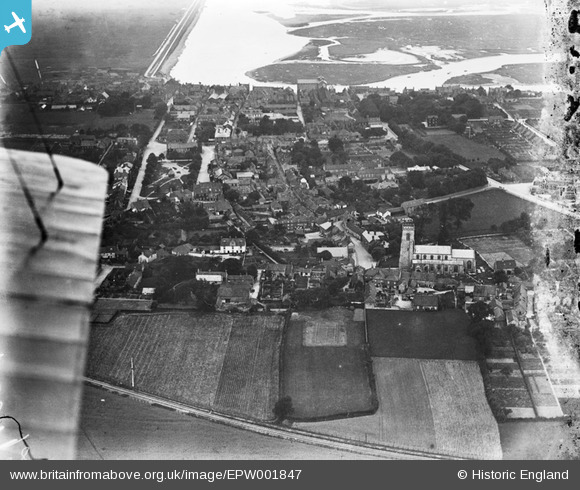
EPW001847 ENGLAND (1920). View of Wells-Next-The-Sea and St Nicholas's Church, Wells-Next-The-Sea, 1920
© Copyright OpenStreetMap contributors and licensed by the OpenStreetMap Foundation. 2026. Cartography is licensed as CC BY-SA.
Nearby Images (2)
EPW001847

EPW001846

Details
| Title | [EPW001847] View of Wells-Next-The-Sea and St Nicholas's Church, Wells-Next-The-Sea, 1920 |
| Reference | EPW001847 |
| Date | June-1920 |
| Link | |
| Place name | WELLS-NEXT-THE-SEA |
| Parish | WELLS-NEXT-THE-SEA |
| District | |
| Country | ENGLAND |
| Easting / Northing | 591739, 343222 |
| Longitude / Latitude | 0.85448633692431, 52.951742512496 |
| National Grid Reference | TF917432 |
Pins
 |

melgibbs |
Tuesday 4th of March 2014 08:04:22 PM |

Peter |
Tuesday 11th of December 2012 09:48:41 PM | |
|
Peter |
Tuesday 11th of December 2012 09:47:28 PM | |
|
Peter |
Tuesday 11th of December 2012 09:46:32 PM | |
|
Peter |
Tuesday 11th of December 2012 09:45:02 PM | |
|
Peter |
Tuesday 11th of December 2012 09:44:15 PM | |
|
Peter |
Tuesday 11th of December 2012 09:42:37 PM | |
|
Peter |
Tuesday 11th of December 2012 09:41:21 PM |