
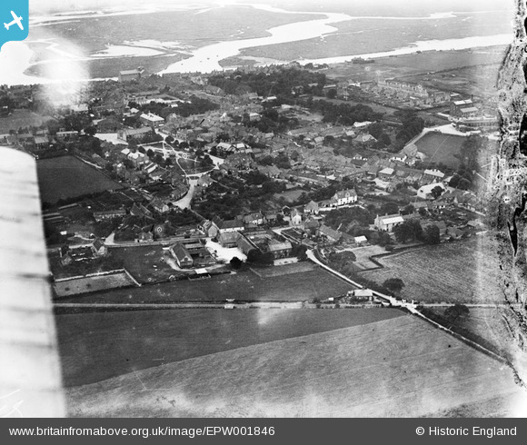
EPW001846 ENGLAND (1920). View of the town, Wells-Next-The-Sea, 1920
© Copyright OpenStreetMap contributors and licensed by the OpenStreetMap Foundation. 2026. Cartography is licensed as CC BY-SA.
Nearby Images (2)
EPW001846

EPW001847

Details
| Title | [EPW001846] View of the town, Wells-Next-The-Sea, 1920 |
| Reference | EPW001846 |
| Date | June-1920 |
| Link | |
| Place name | WELLS-NEXT-THE-SEA |
| Parish | WELLS-NEXT-THE-SEA |
| District | |
| Country | ENGLAND |
| Easting / Northing | 591643, 343200 |
| Longitude / Latitude | 0.85304607606484, 52.951579266844 |
| National Grid Reference | TF916432 |
Pins
 |

melgibbs |
Tuesday 4th of March 2014 08:05:46 PM |

Ellensdottir |
Friday 4th of October 2013 04:31:19 PM | |
|
Peter |
Tuesday 11th of December 2012 09:57:36 PM | |
|
Peter |
Tuesday 11th of December 2012 09:56:32 PM | |
|
Peter |
Tuesday 11th of December 2012 09:55:11 PM | |
|
Peter |
Tuesday 11th of December 2012 09:53:27 PM | |
|
Peter |
Tuesday 11th of December 2012 09:51:56 PM |