
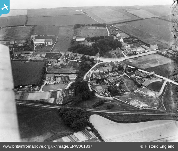
EPW001837 ENGLAND (1920). Cromer Road and Holy Trinity Church, West Runton, 1920
© Copyright OpenStreetMap contributors and licensed by the OpenStreetMap Foundation. 2026. Cartography is licensed as CC BY-SA.
Nearby Images (2)
EPW001837

EPW001836

Details
| Title | [EPW001837] Cromer Road and Holy Trinity Church, West Runton, 1920 |
| Reference | EPW001837 |
| Date | June-1920 |
| Link | |
| Place name | WEST RUNTON |
| Parish | RUNTON |
| District | |
| Country | ENGLAND |
| Easting / Northing | 618024, 342677 |
| Longitude / Latitude | 1.2447901364596, 52.936816630115 |
| National Grid Reference | TG180427 |
Pins

Matt Aldred edob.mattaldred.com |
Friday 18th of July 2025 10:25:24 AM | |
|
Matt Aldred edob.mattaldred.com |
Saturday 5th of December 2020 02:21:54 PM | |

Chris Booty |
Wednesday 18th of April 2018 08:01:26 PM | |
|
Chris Kolonko |
Monday 2nd of October 2017 09:13:28 PM | |
|
Chris Kolonko |
Monday 2nd of October 2017 09:10:18 PM | |

Class31 |
Monday 3rd of September 2012 09:41:07 PM |