
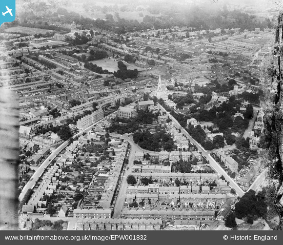
EPW001832 ENGLAND (1920). St Matthew's Street and United Reformed Church area, Ipswich, 1920
© Copyright OpenStreetMap contributors and licensed by the OpenStreetMap Foundation. 2026. Cartography is licensed as CC BY-SA.
Nearby Images (4)
EPW001832

EPW001829

EPW005256

EPW058752

Details
| Title | [EPW001832] St Matthew's Street and United Reformed Church area, Ipswich, 1920 |
| Reference | EPW001832 |
| Date | June-1920 |
| Link | |
| Place name | IPSWICH |
| Parish | |
| District | |
| Country | ENGLAND |
| Easting / Northing | 615635, 244810 |
| Longitude / Latitude | 1.1458917242149, 52.059215113073 |
| National Grid Reference | TM156448 |
Pins
Be the first to add a comment to this image!