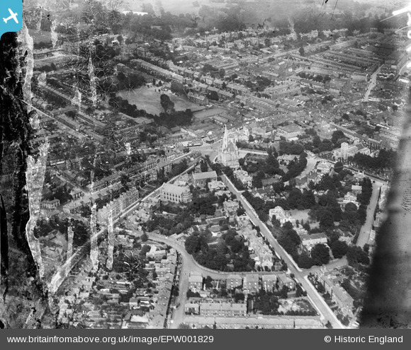
EPW001829 ENGLAND (1920). St Matthew's Street and United Reformed Church, Ipswich, 1920
© Copyright OpenStreetMap contributors and licensed by the OpenStreetMap Foundation. 2026. Cartography is licensed as CC BY-SA.
Details
| Title | [EPW001829] St Matthew's Street and United Reformed Church, Ipswich, 1920 |
| Reference | EPW001829 |
| Date | June-1920 |
| Link | |
| Place name | IPSWICH |
| Parish | |
| District | |
| Country | ENGLAND |
| Easting / Northing | 615700, 244851 |
| Longitude / Latitude | 1.1468643527242, 52.059557915247 |
| National Grid Reference | TM157449 |
Pins

Gainsboroughvilla |
Thursday 6th of September 2012 08:06:51 PM |
User Comment Contributions
If the photo was taken in 1920 it cannot show a United Reformed Church(URC). The URC only came into existence in 1972. The large church shown is probably the Presbyterian Church which in 1972 became part of the URC |

Shetland Charlie |
Monday 4th of January 2016 08:57:27 PM |


![[EPW001829] St Matthew's Street and United Reformed Church, Ipswich, 1920](http://britainfromabove.org.uk/sites/all/libraries/aerofilms-images/public/100x100/EPW/001/EPW001829.jpg)
![[EPW005256] United Reformed Church and Burlington Road, Ipswich, 1921](http://britainfromabove.org.uk/sites/all/libraries/aerofilms-images/public/100x100/EPW/005/EPW005256.jpg)
![[EPW001832] St Matthew's Street and United Reformed Church area, Ipswich, 1920](http://britainfromabove.org.uk/sites/all/libraries/aerofilms-images/public/100x100/EPW/001/EPW001832.jpg)