
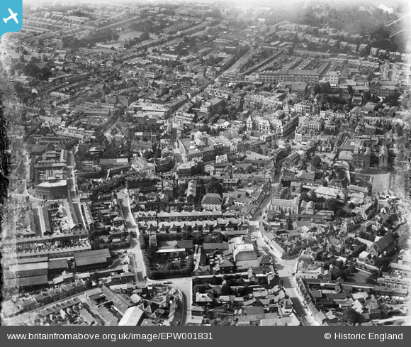
EPW001831 ENGLAND (1920). View of Friars Street area, Ipswich, 1920
© Copyright OpenStreetMap contributors and licensed by the OpenStreetMap Foundation. 2026. Cartography is licensed as CC BY-SA.
Nearby Images (12)
EPW001831

EPW005252

EPW032875

EPW005249

EPW005255

EPW059178

EPW058744

EPW005298A

EPW001824

EPW001834

EPW001823

EPW041399

Details
| Title | [EPW001831] View of Friars Street area, Ipswich, 1920 |
| Reference | EPW001831 |
| Date | June-1920 |
| Link | |
| Place name | IPSWICH |
| Parish | |
| District | |
| Country | ENGLAND |
| Easting / Northing | 616145, 244462 |
| Longitude / Latitude | 1.15309972217, 52.055892055786 |
| National Grid Reference | TM161445 |
Pins

pf329 |
Wednesday 24th of July 2019 09:53:41 AM | |
|
pf329 |
Wednesday 24th of July 2019 09:53:11 AM | |
|
pf329 |
Wednesday 24th of July 2019 09:52:41 AM | |
|
pf329 |
Wednesday 24th of July 2019 09:51:43 AM | |
|
pf329 |
Wednesday 24th of July 2019 09:50:19 AM | |
|
pf329 |
Sunday 16th of June 2019 11:19:25 AM |