
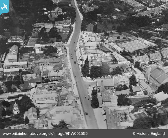
EPW001555 ENGLAND (1920). The High Street, Watford, 1920. This image has been produced from a copy-negative.
© Copyright OpenStreetMap contributors and licensed by the OpenStreetMap Foundation. 2026. Cartography is licensed as CC BY-SA.
Nearby Images (10)
EPW001555

EAW028659

EPW037382

EAW018528

EPW001550

EPW037383

EPW021444

EPW037380

EAW026500

EPW051578

Details
| Title | [EPW001555] The High Street, Watford, 1920. This image has been produced from a copy-negative. |
| Reference | EPW001555 |
| Date | June-1920 |
| Link | |
| Place name | WATFORD |
| Parish | |
| District | |
| Country | ENGLAND |
| Easting / Northing | 510897, 196563 |
| Longitude / Latitude | -0.39665744251064, 51.656434982802 |
| National Grid Reference | TQ109966 |
Pins

Graham |
Monday 27th of November 2017 04:32:47 PM |