
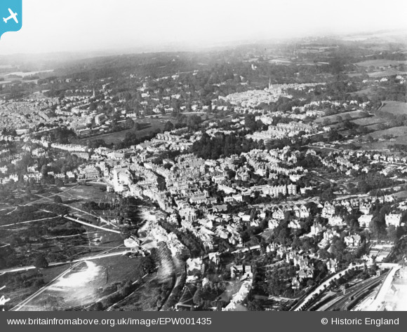
EPW001435 ENGLAND (1920). Tunbridge Wells Common and the town, Royal Tunbridge Wells, from the south-west, 1920. This image has been produced from a copy-negative.
© Copyright OpenStreetMap contributors and licensed by the OpenStreetMap Foundation. 2025. Cartography is licensed as CC BY-SA.
Nearby Images (2)
EPW001435

EPW011455

Details
| Title | [EPW001435] Tunbridge Wells Common and the town, Royal Tunbridge Wells, from the south-west, 1920. This image has been produced from a copy-negative. |
| Reference | EPW001435 |
| Date | 8-June-1920 |
| Link | |
| Place name | ROYAL TUNBRIDGE WELLS |
| Parish | |
| District | |
| Country | ENGLAND |
| Easting / Northing | 558097, 138701 |
| Longitude / Latitude | 0.25949646189466, 51.12521645517 |
| National Grid Reference | TQ581387 |
Pins
Be the first to add a comment to this image!