
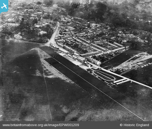
EPW001209 ENGLAND (1920). Warwick Racecourse and Grandstand and Paddock, Warwick, 1920
© Copyright OpenStreetMap contributors and licensed by the OpenStreetMap Foundation. 2026. Cartography is licensed as CC BY-SA.
Nearby Images (5)
EPW001209

EAW044048

EAW044050

EAW044047

EAW044049

Details
| Title | [EPW001209] Warwick Racecourse and Grandstand and Paddock, Warwick, 1920 |
| Reference | EPW001209 |
| Date | May-1920 |
| Link | |
| Place name | WARWICK |
| Parish | WARWICK |
| District | |
| Country | ENGLAND |
| Easting / Northing | 427590, 264555 |
| Longitude / Latitude | -1.5955594426946, 52.278056206785 |
| National Grid Reference | SP276646 |
Pins
Be the first to add a comment to this image!
User Comment Contributions

Warwick Racecourse |

Robert - Cumbria |
Tuesday 26th of June 2012 11:19:54 PM |