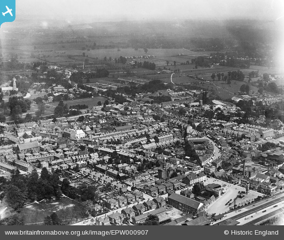
EPW000907 ENGLAND (1920). View of Maidenhead from the station, Maidenhead, from the south-west, 1920
© Copyright OpenStreetMap contributors and licensed by the OpenStreetMap Foundation. 2025. Cartography is licensed as CC BY-SA.
Nearby Images (6)
Details
| Title | [EPW000907] View of Maidenhead from the station, Maidenhead, from the south-west, 1920 |
| Reference | EPW000907 |
| Date | May-1920 |
| Link | |
| Place name | MAIDENHEAD |
| Parish | |
| District | |
| Country | ENGLAND |
| Easting / Northing | 488684, 180852 |
| Longitude / Latitude | -0.72168523014948, 51.519135896277 |
| National Grid Reference | SU887809 |
Pins
 misterjohn |
Friday 30th of December 2022 12:39:39 PM | |
 misterjohn |
Friday 30th of December 2022 12:38:41 PM | |
 peter stuart legat |
Monday 24th of August 2020 03:48:14 PM | |
 Chris |
Saturday 5th of March 2016 12:40:28 PM | |
 David960 |
Saturday 31st of January 2015 04:46:02 PM | |
 David960 |
Saturday 31st of January 2015 04:44:39 PM | |
 David960 |
Saturday 31st of January 2015 04:43:12 PM | |
 David960 |
Saturday 31st of January 2015 04:42:15 PM |


![[EPW000907] View of Maidenhead from the station, Maidenhead, from the south-west, 1920](http://britainfromabove.org.uk/sites/all/libraries/aerofilms-images/public/100x100/EPW/000/EPW000907.jpg)
![[EPW000909] King Street and environs, Maidenhead, from the south-west, 1920. This image has been produced from a copy-negative.](http://britainfromabove.org.uk/sites/all/libraries/aerofilms-images/public/100x100/EPW/000/EPW000909.jpg)
![[EAW026480] Maidenhead Railway Station and the town, Maidenhead, from the south, 1949](http://britainfromabove.org.uk/sites/all/libraries/aerofilms-images/public/100x100/EAW/026/EAW026480.jpg)
![[EPW022623] The Clock Tower and Edwards Tent Works, Maidenhead, 1928](http://britainfromabove.org.uk/sites/all/libraries/aerofilms-images/public/100x100/EPW/022/EPW022623.jpg)
![[EPW000905] View of Maidenhead and station, Maidenhead, from the south-east, 1920](http://britainfromabove.org.uk/sites/all/libraries/aerofilms-images/public/100x100/EPW/000/EPW000905.jpg)
![[EPW022621] Queen Street and surroundings, Maidenhead, 1928](http://britainfromabove.org.uk/sites/all/libraries/aerofilms-images/public/100x100/EPW/022/EPW022621.jpg)