
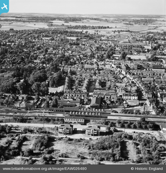
EAW026480 ENGLAND (1949). Maidenhead Railway Station and the town, Maidenhead, from the south, 1949
© Copyright OpenStreetMap contributors and licensed by the OpenStreetMap Foundation. 2025. Cartography is licensed as CC BY-SA.
Nearby Images (5)
EAW026480

EPW000907

EPW022623

EPW000905

EPW000909

Details
| Title | [EAW026480] Maidenhead Railway Station and the town, Maidenhead, from the south, 1949 |
| Reference | EAW026480 |
| Date | 10-September-1949 |
| Link | |
| Place name | MAIDENHEAD |
| Parish | |
| District | |
| Country | ENGLAND |
| Easting / Northing | 488703, 180724 |
| Longitude / Latitude | -0.72144365885845, 51.517982161757 |
| National Grid Reference | SU887807 |
Pins
 spikey1810 |
Friday 11th of October 2024 02:57:11 PM | |
misterjohn |
Tuesday 3rd of January 2023 09:36:40 AM | |
misterjohn |
Tuesday 3rd of January 2023 09:34:44 AM | |
cafestop |
Monday 27th of November 2017 10:31:15 AM | |
Chris |
Saturday 5th of November 2016 11:10:06 AM | |
Chris |
Saturday 5th of March 2016 12:58:26 PM | |
Chris |
Saturday 5th of March 2016 12:57:38 PM |