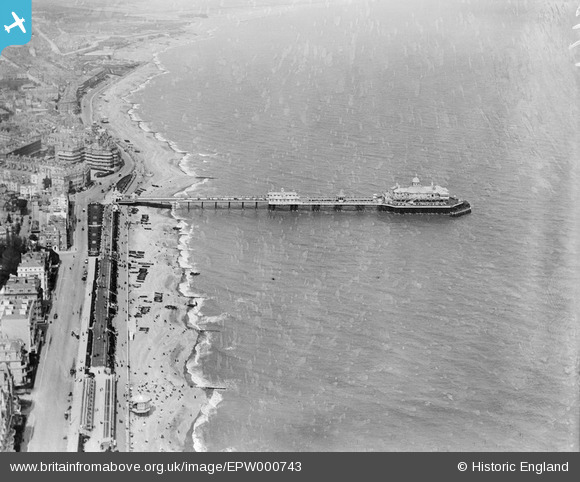
EPW000743 ENGLAND (1920). The Pier, Eastbourne, from the south-west, 1920
© Copyright OpenStreetMap contributors and licensed by the OpenStreetMap Foundation. 2026. Cartography is licensed as CC BY-SA.
Nearby Images (15)
Details
| Title | [EPW000743] The Pier, Eastbourne, from the south-west, 1920 |
| Reference | EPW000743 |
| Date | April-1920 |
| Link | |
| Place name | EASTBOURNE |
| Parish | |
| District | |
| Country | ENGLAND |
| Easting / Northing | 561763, 98638 |
| Longitude / Latitude | 0.29404919563742, 50.764183029322 |
| National Grid Reference | TV618986 |
Pins

HighEye |
Saturday 27th of September 2025 02:08:34 PM | |

HighEye |
Saturday 27th of September 2025 02:07:24 PM | |

Mikeo1938 |
Monday 6th of October 2014 02:42:19 PM | |

Alan McFaden |
Monday 22nd of July 2013 11:38:04 AM | |

Alan McFaden |
Monday 22nd of July 2013 11:36:51 AM | |

Alan McFaden |
Monday 22nd of July 2013 11:36:12 AM | |
This is a nice picture but adds little to the historical content and is merely cluttering up the image. |

Mikeo1938 |
Monday 6th of October 2014 02:43:44 PM |

Alan McFaden |
Monday 22nd of July 2013 11:35:33 AM | |

Alan McFaden |
Monday 22nd of July 2013 11:34:54 AM | |

Alan McFaden |
Monday 22nd of July 2013 11:34:17 AM | |

Alan McFaden |
Monday 22nd of July 2013 11:33:31 AM | |

Alan McFaden |
Monday 22nd of July 2013 11:33:00 AM |
User Comment Contributions

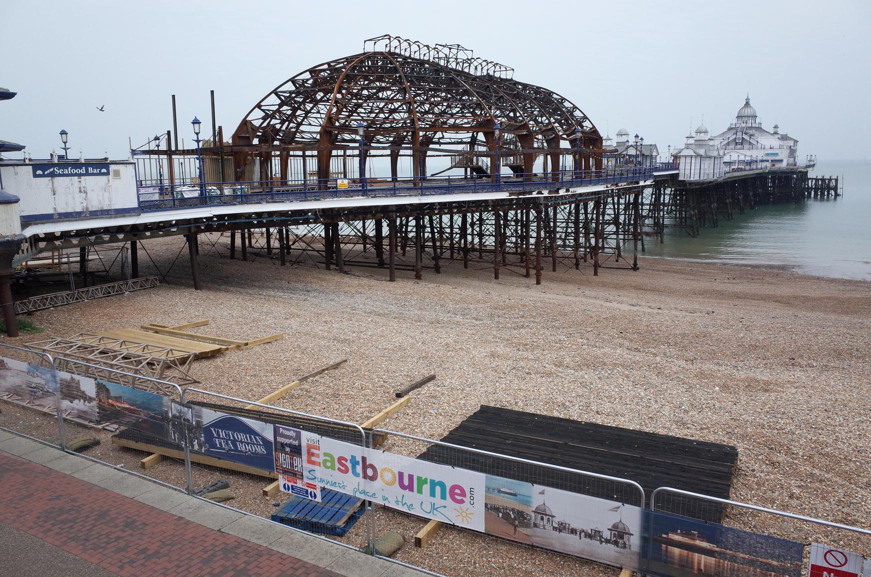
Eastbourne Pier Fire Damage September 2014 |

Alan McFaden |
Wednesday 8th of October 2014 10:30:47 AM |
Piers were often originally built so that steamers bringing Victorian tourists could tie up to unload their passengers. They developed into places for walking and entertainment. See more images of the seaside from the English Heritage Archive collections on Heritage Explorer http://www.heritage-explorer.co.uk/web/he/imagebytheme.aspx?ctid=4 |

MM |
Thursday 21st of March 2013 10:00:55 AM |


![[EPW000743] The Pier, Eastbourne, from the south-west, 1920](http://britainfromabove.org.uk/sites/all/libraries/aerofilms-images/public/100x100/EPW/000/EPW000743.jpg)
![[EPW035323] The Cavendish Hotel and Grand Parade, Eastbourne, from the south-east, 1931](http://britainfromabove.org.uk/sites/all/libraries/aerofilms-images/public/100x100/EPW/035/EPW035323.jpg)
![[EPW000746] The Pier, Eastbourne, 1920](http://britainfromabove.org.uk/sites/all/libraries/aerofilms-images/public/100x100/EPW/000/EPW000746.jpg)
![[EPW035324] The pier, Eastbourne, 1931](http://britainfromabove.org.uk/sites/all/libraries/aerofilms-images/public/100x100/EPW/035/EPW035324.jpg)
![[EPW046004] The Grand Parade, Eastbourne, 1934](http://britainfromabove.org.uk/sites/all/libraries/aerofilms-images/public/100x100/EPW/046/EPW046004.jpg)
![[EPW046005] The Grand Parade, Eastbourne, 1934](http://britainfromabove.org.uk/sites/all/libraries/aerofilms-images/public/100x100/EPW/046/EPW046005.jpg)
![[EPW046006] The Grand Parade, Eastbourne, 1934](http://britainfromabove.org.uk/sites/all/libraries/aerofilms-images/public/100x100/EPW/046/EPW046006.jpg)
![[EPW039403] The Grand Parade, the Pier Music Pavilion and the town, Eastbourne, 1932](http://britainfromabove.org.uk/sites/all/libraries/aerofilms-images/public/100x100/EPW/039/EPW039403.jpg)
![[EPW046003] The Grand Parade, Eastbourne, 1934](http://britainfromabove.org.uk/sites/all/libraries/aerofilms-images/public/100x100/EPW/046/EPW046003.jpg)
![[EPW000067] Eastbourne Pier, Eastbourne, 1920](http://britainfromabove.org.uk/sites/all/libraries/aerofilms-images/public/100x100/EPW/000/EPW000067.jpg)
![[EPW000100] Seated Statue of Seventh Duke of Devonshire and Bandstand, Eastbourne, 1920](http://britainfromabove.org.uk/sites/all/libraries/aerofilms-images/public/100x100/EPW/000/EPW000100.jpg)
![[EAW006144] The bandstand, Cavendish Hotel and the town, Eastbourne, from the south-east, 1947](http://britainfromabove.org.uk/sites/all/libraries/aerofilms-images/public/100x100/EAW/006/EAW006144.jpg)
![[EAW006146] The pier, Eastbourne, 1947](http://britainfromabove.org.uk/sites/all/libraries/aerofilms-images/public/100x100/EAW/006/EAW006146.jpg)
![[EAW006139] Seafront hotels along Grand Parade, the bandstand and the beach, Eastbourne, 1947. This image was marked by Aerofilms Ltd for photo editing.](http://britainfromabove.org.uk/sites/all/libraries/aerofilms-images/public/100x100/EAW/006/EAW006139.jpg)
![[EAW006145] Hotels along Grand Parade, the seafront and the town, Eastbourne, from the south-east, 1947](http://britainfromabove.org.uk/sites/all/libraries/aerofilms-images/public/100x100/EAW/006/EAW006145.jpg)


