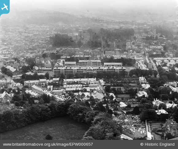
EPW000657 ENGLAND (1920). Winchester Barracks, Winchester, 1920
© Copyright OpenStreetMap contributors and licensed by the OpenStreetMap Foundation. 2025. Cartography is licensed as CC BY-SA.
Nearby Images (7)
Details
| Title | [EPW000657] Winchester Barracks, Winchester, 1920 |
| Reference | EPW000657 |
| Date | April-1920 |
| Link | |
| Place name | WINCHESTER |
| Parish | |
| District | |
| Country | ENGLAND |
| Easting / Northing | 447406, 129497 |
| Longitude / Latitude | -1.3234335153071, 51.062316265728 |
| National Grid Reference | SU474295 |


![[EPW000657] Winchester Barracks, Winchester, 1920](http://britainfromabove.org.uk/sites/all/libraries/aerofilms-images/public/100x100/EPW/000/EPW000657.jpg)
![[EAW051302] HM Prison and environs, Winchester, 1953](http://britainfromabove.org.uk/sites/all/libraries/aerofilms-images/public/100x100/EAW/051/EAW051302.jpg)
![[EAW051305] HM Prison and environs, Winchester, 1953](http://britainfromabove.org.uk/sites/all/libraries/aerofilms-images/public/100x100/EAW/051/EAW051305.jpg)
![[EPW000693] Winchester Prison and the Royal Hampshire County Hospital, Winchester, 1920](http://britainfromabove.org.uk/sites/all/libraries/aerofilms-images/public/100x100/EPW/000/EPW000693.jpg)
![[EPW023327] Winchester Prison, Winchester, 1928](http://britainfromabove.org.uk/sites/all/libraries/aerofilms-images/public/100x100/EPW/023/EPW023327.jpg)
![[EAW008852] Winchester Prison, Winchester, 1947](http://britainfromabove.org.uk/sites/all/libraries/aerofilms-images/public/100x100/EAW/008/EAW008852.jpg)
![[EPW000701] Winchester Prison, Winchester, from the north-east, 1920](http://britainfromabove.org.uk/sites/all/libraries/aerofilms-images/public/100x100/EPW/000/EPW000701.jpg)
