
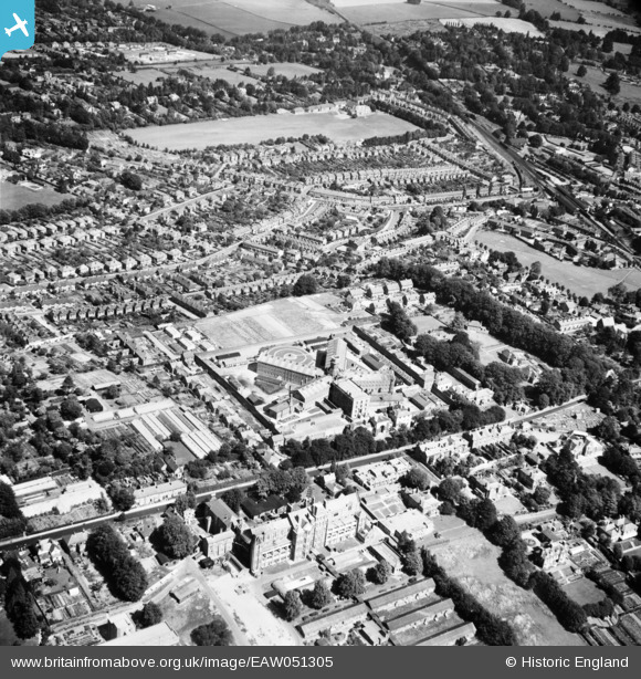
EAW051305 ENGLAND (1953). HM Prison and environs, Winchester, 1953
© Copyright OpenStreetMap contributors and licensed by the OpenStreetMap Foundation. 2025. Cartography is licensed as CC BY-SA.
Nearby Images (8)
EAW051305

EAW051302

EAW008852

EPW000701

EPW023327

EPW000707

EPW000693

EPW000657

Details
| Title | [EAW051305] HM Prison and environs, Winchester, 1953 |
| Reference | EAW051305 |
| Date | 8-August-1953 |
| Link | |
| Place name | WINCHESTER |
| Parish | |
| District | |
| Country | ENGLAND |
| Easting / Northing | 447227, 129635 |
| Longitude / Latitude | -1.3259699471368, 51.063571995912 |
| National Grid Reference | SU472296 |
Pins
Be the first to add a comment to this image!