
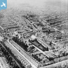
EPW000560 ENGLAND (1920). Warrior Square, Southend-on-Sea, from the south-east, 1920

© Copyright OpenStreetMap contributors and licensed by the OpenStreetMap Foundation. 2026. Cartography is licensed as CC BY-SA.
Nearby Images (4)
EPW000560
 0°
0m
0°
0m
EPW000548
 312°
178m
312°
178m
EPW000558
 293°
251m
293°
251m
EPW000540
 221°
305m
221°
305m
Details
| Title | [EPW000560] Warrior Square, Southend-on-Sea, from the south-east, 1920 |
| Reference | EPW000560 |
| Date | April-1920 |
| Link | |
| Place name | SOUTHEND-ON-SEA |
| Parish | |
| District | |
| Country | ENGLAND |
| Easting / Northing | 588383, 185744 |
| Longitude / Latitude | 0.71674182326329, 51.538633189095 |
| National Grid Reference | TQ884857 |
Pins
 bus station. bus station. |

Sara |
Saturday 18th of July 2026 04:42:40 AM |
| Victoria Avenue, houses mostly demolished for road widening and then replaced by office blocks along one side, now all redundant and converted to blocks of flats. |
Sara |
Saturday 18th of July 2026 04:41:36 AM |
| Southend Central Library, now the museum. |
Sara |
Saturday 18th of July 2026 04:39:58 AM |
| Henry Luker & Co Ltd, Middletown Brewery, 123 High Street, Southend. Luker's Brewery moved from their original site in Brewery Road (now Southchurch Avenue) to a new brewery at 123 High Street in 1869. Luker's purchaed the Anchor Brewery, Rayleigh in 1884 which closed in 1917 due to wartime restrictions. Purchased by Mann, Crossman & Paulins Brewery in 1929. Middletown Brewery was demolished to make way for the Southend Astoria which opened in July 1935. |
Stu Giles |
Friday 6th of July 2018 03:44:46 PM |
| Southend art school. |
Kollage Kid |
Monday 22nd of April 2013 05:01:34 PM |
| Warrior Square |
EZTD |
Tuesday 3rd of July 2012 10:14:04 PM |
| Whitegate Road |
EZTD |
Tuesday 3rd of July 2012 10:13:18 PM |
| London, Tilbury and Southend Line between Fenchurch Street and Shoeburyness |
EZTD |
Tuesday 3rd of July 2012 09:59:57 PM |
| Municipal College |
EZTD |
Tuesday 3rd of July 2012 09:57:54 PM |
| Southend Victoria Station |
EZTD |
Tuesday 3rd of July 2012 09:57:06 PM |