
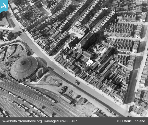
EPW000437 ENGLAND (1920). Chappell Piano Factory, Chalk Farm, London, 1920
© Copyright OpenStreetMap contributors and licensed by the OpenStreetMap Foundation. 2026. Cartography is licensed as CC BY-SA.
Nearby Images (9)
EPW000437

EPW000804

EPW000434

EPW000803

EPW000433

EPW000806

EPW000807

EAW000621

EPW000808

Details
| Title | [EPW000437] Chappell Piano Factory, Chalk Farm, London, 1920 |
| Reference | EPW000437 |
| Date | April-1920 |
| Link | |
| Place name | CAMDEN TOWN |
| Parish | |
| District | |
| Country | ENGLAND |
| Easting / Northing | 528338, 184357 |
| Longitude / Latitude | -0.14909554147985, 51.543019708364 |
| National Grid Reference | TQ283844 |
Pins

billyfern |
Wednesday 2nd of July 2014 04:50:42 PM | |
|
billyfern |
Wednesday 2nd of July 2014 04:50:19 PM | |
|
billyfern |
Wednesday 2nd of July 2014 04:49:56 PM | |
|
billyfern |
Wednesday 2nd of July 2014 04:49:36 PM | |
|
billyfern |
Wednesday 2nd of July 2014 04:49:18 PM | |

Class31 |
Monday 14th of October 2013 08:00:45 AM | |
|
Class31 |
Monday 14th of October 2013 07:59:53 AM | |
|
Class31 |
Monday 14th of October 2013 07:59:23 AM | |
|
FermePark |
Saturday 16th of March 2013 10:36:34 PM |
User Comment Contributions

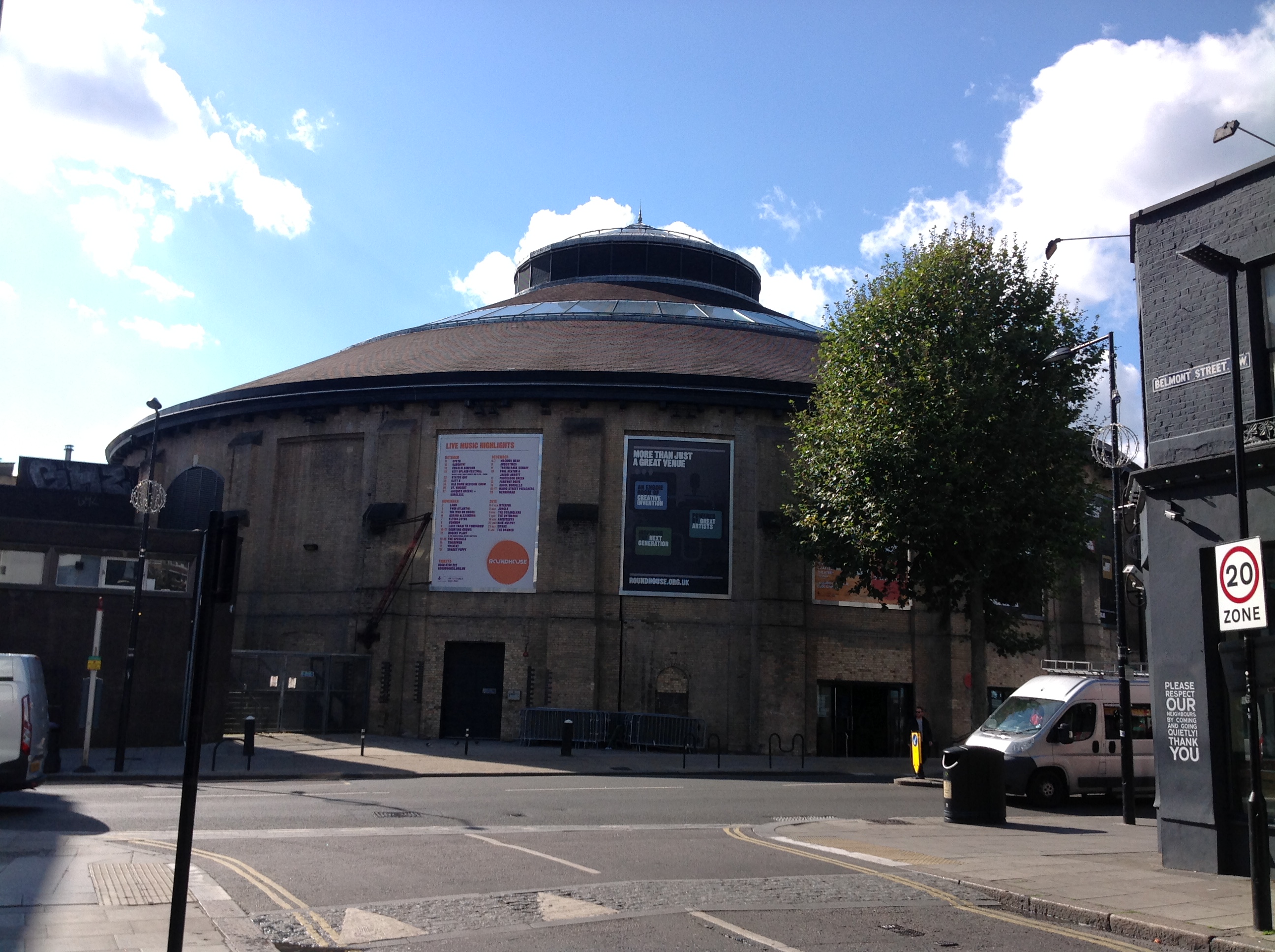
The Roundhouse, 07/10/2014 |
Class31 |
Wednesday 8th of October 2014 04:50:14 PM |
The Roundhouse, 07/10/2014 |
Class31 |
Wednesday 8th of October 2014 04:49:46 PM |

Chalk Farm Underground Station, 07/10/2014 |
Class31 |
Wednesday 8th of October 2014 04:48:55 PM |
View looking north west. |
Class31 |
Monday 14th of October 2013 08:01:51 AM |