
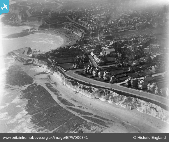
EPW000341 ENGLAND (1920). Broadstairs, Kent, 1920
© Copyright OpenStreetMap contributors and licensed by the OpenStreetMap Foundation. 2026. Cartography is licensed as CC BY-SA.
Nearby Images (6)
EPW000341

EPW000342

EPW000343

EPW000119

EPW000610

EPW009186

Details
| Title | [EPW000341] Broadstairs, Kent, 1920 |
| Reference | EPW000341 |
| Date | April-1920 |
| Link | |
| Place name | BROADSTAIRS |
| Parish | BROADSTAIRS AND ST. PETERS |
| District | |
| Country | ENGLAND |
| Easting / Northing | 639915, 168077 |
| Longitude / Latitude | 1.4466324774222, 51.360507101488 |
| National Grid Reference | TR399681 |
Pins
Be the first to add a comment to this image!