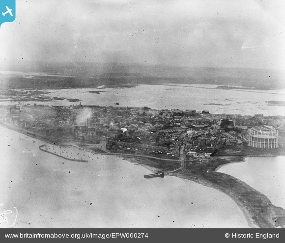
EPW000274 ENGLAND (1920). Poole and Poole Bay, from the south-east, 1920
© Copyright OpenStreetMap contributors and licensed by the OpenStreetMap Foundation. 2026. Cartography is licensed as CC BY-SA.
Details
| Title | [EPW000274] Poole and Poole Bay, from the south-east, 1920 |
| Reference | EPW000274 |
| Date | April-1920 |
| Link | |
| Place name | POOLE |
| Parish | |
| District | |
| Country | ENGLAND |
| Easting / Northing | 401046, 90471 |
| Longitude / Latitude | -1.9851829592431, 50.713294938915 |
| National Grid Reference | SZ010905 |
Pins

KeithFP |
Thursday 8th of November 2012 12:41:13 PM | |

KeithFP |
Thursday 8th of November 2012 12:39:58 PM | |

KeithFP |
Thursday 8th of November 2012 12:37:17 PM | |

KeithFP |
Thursday 8th of November 2012 12:36:46 PM | |

KeithFP |
Thursday 8th of November 2012 12:34:47 PM |


![[EPW000274] Poole and Poole Bay, from the south-east, 1920](http://britainfromabove.org.uk/sites/all/libraries/aerofilms-images/public/100x100/EPW/000/EPW000274.jpg)
![[EPW013629] The Old Town, Poole, 1925. This image has been produced from a copy-negative.](http://britainfromabove.org.uk/sites/all/libraries/aerofilms-images/public/100x100/EPW/013/EPW013629.jpg)
![[EAW018153] Lower Hamworthy, Old Town and Holes Bay, Poole, from the south-east, 1948. This image has been produced from a print.](http://britainfromabove.org.uk/sites/all/libraries/aerofilms-images/public/100x100/EAW/018/EAW018153.jpg)
![[EPW013632] Quay Channel and the Old Town, Poole, 1925. This image has been produced from a copy-negative.](http://britainfromabove.org.uk/sites/all/libraries/aerofilms-images/public/100x100/EPW/013/EPW013632.jpg)