
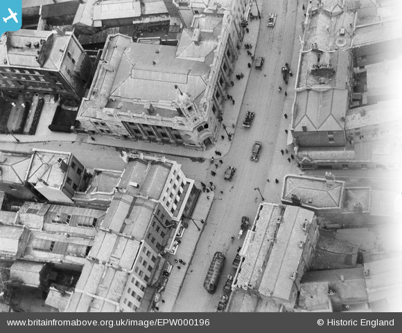
EPW000196 ENGLAND (1920). Lloyds Bank, High Street, Cheltenham, 1920
© Copyright OpenStreetMap contributors and licensed by the OpenStreetMap Foundation. 2026. Cartography is licensed as CC BY-SA.
Nearby Images (5)
EPW000196

EPR000386

EPW000198

EPW000197

EPW000169

Details
| Title | [EPW000196] Lloyds Bank, High Street, Cheltenham, 1920 |
| Reference | EPW000196 |
| Date | February-1920 |
| Link | |
| Place name | CHELTENHAM |
| Parish | |
| District | |
| Country | ENGLAND |
| Easting / Northing | 395078, 222347 |
| Longitude / Latitude | -2.0715427758402, 51.899209372442 |
| National Grid Reference | SO951223 |
Pins

MB |
Sunday 3rd of November 2013 10:36:28 PM | |
|
Richcl |
Sunday 5th of May 2013 12:13:54 PM | |
|
Richcl |
Sunday 5th of May 2013 12:12:58 PM | |
|
Toby Clempson |
Wednesday 27th of June 2012 07:29:56 AM | |
Was opened in 1901 and closed 1930. 3ft 6inch gauge and about 10 miles in length with three routes. The company had proposed to replace the trams with trolley-buses, but local authority opposition resulted in the trams being replaced by motor buses. |
John W |
Monday 22nd of August 2016 11:36:17 PM |