
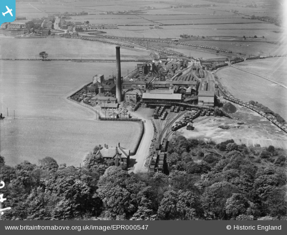
EPR000547 ENGLAND (1935). Park Collieries, Garswood, 1935
© Copyright OpenStreetMap contributors and licensed by the OpenStreetMap Foundation. 2025. Cartography is licensed as CC BY-SA.
Nearby Images (6)
EPR000547

EPR000546

EPR000586

EPR000548

EPR000585

EPR000548A

Details
| Title | [EPR000547] Park Collieries, Garswood, 1935 |
| Reference | EPR000547 |
| Date | 11-May-1935 |
| Link | |
| Place name | GARSWOOD |
| Parish | |
| District | |
| Country | ENGLAND |
| Easting / Northing | 356200, 399048 |
| Longitude / Latitude | -2.6601612551197, 53.486070876181 |
| National Grid Reference | SJ562990 |
Pins

chris |
Friday 29th of December 2023 06:54:10 PM | |
|
chris |
Friday 29th of December 2023 06:49:58 PM | |
|
chris |
Tuesday 28th of July 2020 06:46:22 PM | |
|
chris |
Tuesday 28th of July 2020 06:44:45 PM | |
|
cavey |
Wednesday 19th of February 2020 01:23:35 PM | |
|
adamw66 |
Thursday 14th of March 2019 09:13:14 AM | |
|
adamw66 |
Thursday 14th of March 2019 09:12:25 AM | |
|
adamw66 |
Monday 11th of March 2019 12:27:20 PM | |
|
adamw66 |
Wednesday 6th of March 2019 04:38:43 PM | |
|
MB |
Wednesday 12th of November 2014 12:35:18 PM | |
|
MB |
Wednesday 12th of November 2014 12:34:39 PM | |
|
MB |
Wednesday 12th of November 2014 12:34:08 PM | |
|
MB |
Wednesday 12th of November 2014 12:33:24 PM |