
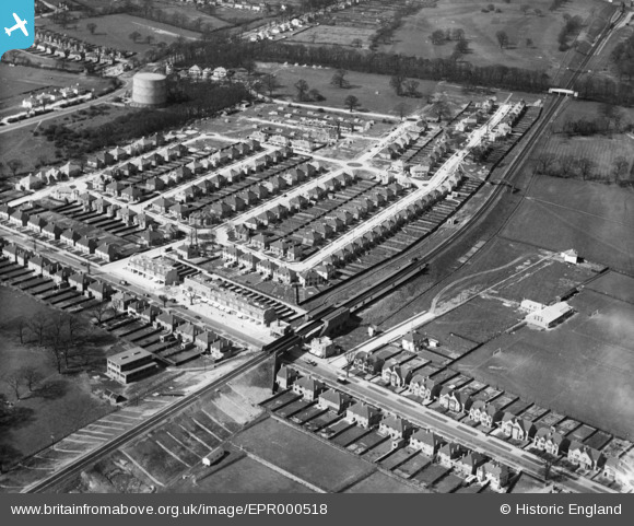
EPR000518 ENGLAND (1935). Whitchurch Lane, Canons Park Station and residential streets around Howberry Road, Canons Park, 1935
© Copyright OpenStreetMap contributors and licensed by the OpenStreetMap Foundation. 2026. Cartography is licensed as CC BY-SA.
Nearby Images (2)
EPR000518

EPW053049

Details
| Title | [EPR000518] Whitchurch Lane, Canons Park Station and residential streets around Howberry Road, Canons Park, 1935 |
| Reference | EPR000518 |
| Date | 27-March-1935 |
| Link | |
| Place name | CANONS PARK |
| Parish | |
| District | |
| Country | ENGLAND |
| Easting / Northing | 518087, 191353 |
| Longitude / Latitude | -0.29451061480946, 51.608141093292 |
| National Grid Reference | TQ181914 |
Pins

KateN |
Monday 16th of April 2018 04:21:41 PM | |
|
KateN |
Monday 16th of April 2018 04:19:16 PM | |
|
The Laird |
Tuesday 2nd of August 2016 01:00:59 PM | |
|
Mark Amies |
Monday 21st of March 2016 01:19:36 PM |