
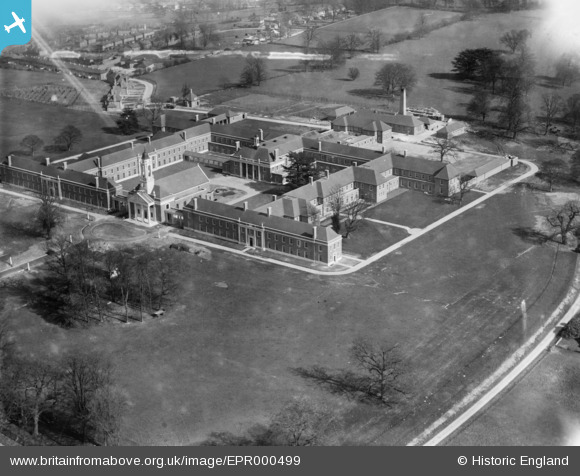
EPR000499 ENGLAND (1935). The Foundling Hospital, Berkhamsted, 1935. This image has been affected by flare.
© Copyright OpenStreetMap contributors and licensed by the OpenStreetMap Foundation. 2026. Cartography is licensed as CC BY-SA.
Nearby Images (8)
EPR000499

EPR000500

EAW004827
, Berkhamsted, 1947")
EAW004828
, Berkhamsted, 1947")
EAW004829
, Berkhamsted, 1947")
EPR000497

EPR000498

EPW056453
, Berkhamsted, 1938")
Details
| Title | [EPR000499] The Foundling Hospital, Berkhamsted, 1935. This image has been affected by flare. |
| Reference | EPR000499 |
| Date | 27-March-1935 |
| Link | |
| Place name | BERKHAMSTED |
| Parish | BERKHAMSTED |
| District | |
| Country | ENGLAND |
| Easting / Northing | 499055, 206976 |
| Longitude / Latitude | -0.56484796995295, 51.752253501766 |
| National Grid Reference | SP991070 |
Pins
Be the first to add a comment to this image!