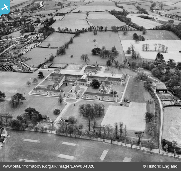
EAW004828 ENGLAND (1947). The Foundling Hospital School (Ashlyns School), Berkhamsted, 1947
© Copyright OpenStreetMap contributors and licensed by the OpenStreetMap Foundation. 2025. Cartography is licensed as CC BY-SA.
Nearby Images (8)
Details
| Title | [EAW004828] The Foundling Hospital School (Ashlyns School), Berkhamsted, 1947 |
| Reference | EAW004828 |
| Date | 29-April-1947 |
| Link | |
| Place name | BERKHAMSTED |
| Parish | BERKHAMSTED |
| District | |
| Country | ENGLAND |
| Easting / Northing | 499152, 206973 |
| Longitude / Latitude | -0.56344392356509, 51.752209369254 |
| National Grid Reference | SP992070 |
Pins

Class31 |
Wednesday 3rd of September 2014 09:15:06 AM |


![[EAW004828] The Foundling Hospital School (Ashlyns School), Berkhamsted, 1947](http://britainfromabove.org.uk/sites/all/libraries/aerofilms-images/public/100x100/EAW/004/EAW004828.jpg)
![[EAW004829] The Foundling Hospital School (Ashlyns School), Berkhamsted, 1947](http://britainfromabove.org.uk/sites/all/libraries/aerofilms-images/public/100x100/EAW/004/EAW004829.jpg)
![[EPR000498] The Foundling Hospital, Berkhamsted, 1935. This image was marked by Aero Pictorial Ltd for photo editing.](http://britainfromabove.org.uk/sites/all/libraries/aerofilms-images/public/100x100/EPR/000/EPR000498.jpg)
![[EPW056453] Ashlyns School (London Foundling Hospital), Berkhamsted, 1938](http://britainfromabove.org.uk/sites/all/libraries/aerofilms-images/public/100x100/EPW/056/EPW056453.jpg)
![[EPR000500] The Foundling Hospital, Berkhamsted, 1935. This image has been produced from a damaged negative.](http://britainfromabove.org.uk/sites/all/libraries/aerofilms-images/public/100x100/EPR/000/EPR000500.jpg)
![[EAW004827] The Foundling Hospital School (Ashlyns School), Berkhamsted, 1947](http://britainfromabove.org.uk/sites/all/libraries/aerofilms-images/public/100x100/EAW/004/EAW004827.jpg)
![[EPR000499] The Foundling Hospital, Berkhamsted, 1935. This image has been affected by flare.](http://britainfromabove.org.uk/sites/all/libraries/aerofilms-images/public/100x100/EPR/000/EPR000499.jpg)
![[EPR000497] The Foundling Hospital, Berkhamsted, 1935. This image was marked by Aero Pictorial Ltd for photo editing.](http://britainfromabove.org.uk/sites/all/libraries/aerofilms-images/public/100x100/EPR/000/EPR000497.jpg)