
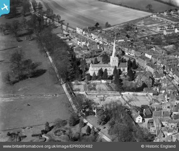
EPR000482 ENGLAND (1935). St Mary's Church and the High Street, Hemel Hempstead, 1935
© Copyright OpenStreetMap contributors and licensed by the OpenStreetMap Foundation. 2026. Cartography is licensed as CC BY-SA.
Nearby Images (20)
EPR000482

EAW014881

EAW017261

EAW017260

EPW017817

EAW017256

EAW017252

EAW014882

EAW017255

EAW017257

EPW017820

EPW017818

EAW017253

EAW017251

EAW017254

EPW052866
 and environs, Hemel Hempstead, 1937")
EPW052865
, Hemel Hempstead, 1937")
EAW014883

EAW014884

EPW022457

Details
| Title | [EPR000482] St Mary's Church and the High Street, Hemel Hempstead, 1935 |
| Reference | EPR000482 |
| Date | 27-March-1935 |
| Link | |
| Place name | HEMEL HEMPSTEAD |
| Parish | |
| District | |
| Country | ENGLAND |
| Easting / Northing | 505483, 207804 |
| Longitude / Latitude | -0.47149964139373, 51.75852255356 |
| National Grid Reference | TL055078 |
Pins
Be the first to add a comment to this image!