
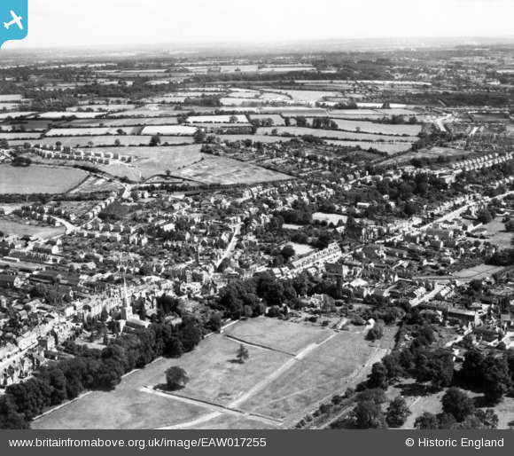
EAW017255 ENGLAND (1948). The town, Hemel Hempstead, from the north-west, 1948. This image has been produced from a print.
© Copyright OpenStreetMap contributors and licensed by the OpenStreetMap Foundation. 2026. Cartography is licensed as CC BY-SA.
Nearby Images (21)
EAW017255

EAW017257

EAW017253

EAW017256

EAW017260

EAW017252

EAW017251

EAW017261

EPR000482

EAW017254

EPW017818

EAW014881

EPW017817

EPW017820

EAW014884

EAW014882

EPW052866
 and environs, Hemel Hempstead, 1937")
EPW052865
, Hemel Hempstead, 1937")
EPW022457

EAW014883

EPW022456

Details
| Title | [EAW017255] The town, Hemel Hempstead, from the north-west, 1948. This image has been produced from a print. |
| Reference | EAW017255 |
| Date | 20-July-1948 |
| Link | |
| Place name | HEMEL HEMPSTEAD |
| Parish | |
| District | |
| Country | ENGLAND |
| Easting / Northing | 505403, 207753 |
| Longitude / Latitude | -0.47267390633275, 51.758079184194 |
| National Grid Reference | TL054078 |
Pins

H.E. |
Wednesday 28th of February 2018 03:02:16 PM | |
|
H.E. |
Wednesday 28th of February 2018 02:56:10 PM | |
|
H.E. |
Wednesday 28th of February 2018 02:55:25 PM | |
|
H.E. |
Wednesday 28th of February 2018 02:54:24 PM | |
|
H.E. |
Wednesday 28th of February 2018 02:52:51 PM | |
|
baza 1969 |
Wednesday 28th of September 2016 12:41:19 PM | |
|
baza 1969 |
Wednesday 28th of September 2016 12:39:43 PM | |
|
Walksleader |
Monday 6th of October 2014 04:26:44 PM |