
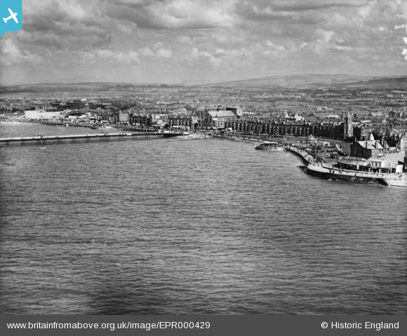
EPR000429 ENGLAND (1934). The town by West End Pier and environs, Morecambe, from the north-west, 1934
© Copyright OpenStreetMap contributors and licensed by the OpenStreetMap Foundation. 2026. Cartography is licensed as CC BY-SA.
Nearby Images (6)
EPR000429

EAW023413

EPW042136

EPW004076

EPW004074

EPW042130

Details
| Title | [EPR000429] The town by West End Pier and environs, Morecambe, from the north-west, 1934 |
| Reference | EPR000429 |
| Date | 30-August-1934 |
| Link | |
| Place name | MORECAMBE |
| Parish | MORECAMBE |
| District | |
| Country | ENGLAND |
| Easting / Northing | 342212, 463783 |
| Longitude / Latitude | -2.8830979416539, 54.066558291942 |
| National Grid Reference | SD422638 |
