
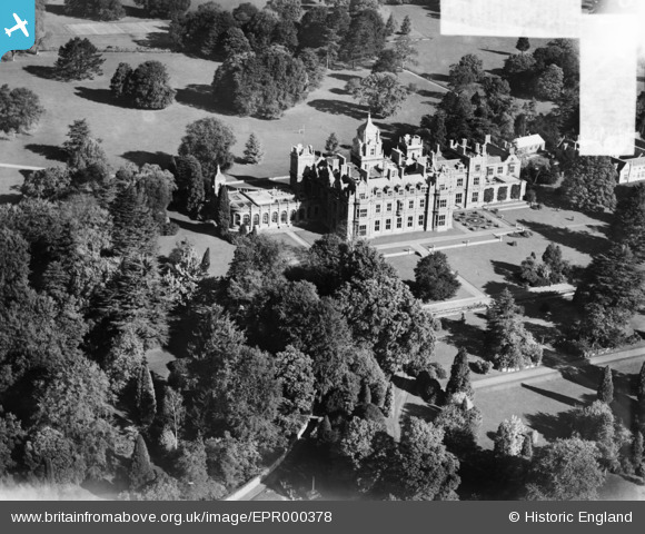
EPR000378 ENGLAND (1934). Westonbirt School, Westonbirt, 1934. This image was marked by Aero Pictorial Ltd for photo editing.
© Copyright OpenStreetMap contributors and licensed by the OpenStreetMap Foundation. 2025. Cartography is licensed as CC BY-SA.
Nearby Images (9)
EPR000378

EPR000379

EAW018027

EAW018025

EPR000376

EAW018029

EAW018026

EAW018028

EPR000377

Details
| Title | [EPR000378] Westonbirt School, Westonbirt, 1934. This image was marked by Aero Pictorial Ltd for photo editing. |
| Reference | EPR000378 |
| Date | 28-October-1934 |
| Link | |
| Place name | WESTONBIRT |
| Parish | WESTONBIRT WITH LASBOROUGH |
| District | |
| Country | ENGLAND |
| Easting / Northing | 386389, 189588 |
| Longitude / Latitude | -2.1965566546233, 51.604493703578 |
| National Grid Reference | ST864896 |
Pins
Be the first to add a comment to this image!