
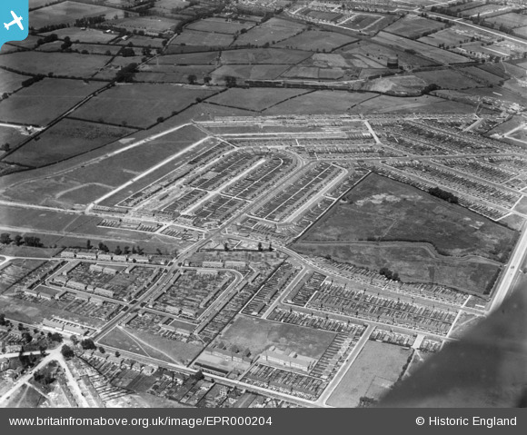
EPR000204 ENGLAND (1934). The Tithe Farm Housing Estate under construction around Kings Road, South Harrow, 1934
© Copyright OpenStreetMap contributors and licensed by the OpenStreetMap Foundation. 2025. Cartography is licensed as CC BY-SA.
Nearby Images (4)
EPR000204

EPR000199

EPR000201

EPR000203

Details
| Title | [EPR000204] The Tithe Farm Housing Estate under construction around Kings Road, South Harrow, 1934 |
| Reference | EPR000204 |
| Date | July-1934 |
| Link | |
| Place name | SOUTH HARROW |
| Parish | |
| District | |
| Country | ENGLAND |
| Easting / Northing | 512666, 186564 |
| Longitude / Latitude | -0.37430692008044, 51.566205045379 |
| National Grid Reference | TQ127866 |
Pins

Keefffff |
Wednesday 19th of November 2014 11:24:40 AM | |
|
Keefffff |
Wednesday 19th of November 2014 11:23:45 AM | |
|
Keefffff |
Wednesday 19th of November 2014 11:23:03 AM | |
|
Keefffff |
Wednesday 19th of November 2014 11:22:30 AM | |
|
Keefffff |
Wednesday 19th of November 2014 11:21:33 AM | |
|
Keefffff |
Wednesday 19th of November 2014 11:20:56 AM |