
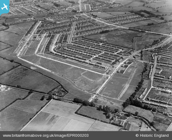
EPR000203 ENGLAND (1934). The Tithe Farm Housing Estate under construction around Clovelly Way, South Harrow, 1934
© Copyright OpenStreetMap contributors and licensed by the OpenStreetMap Foundation. 2025. Cartography is licensed as CC BY-SA.
Nearby Images (3)
EPR000203

EPR000204

EPR000201

Details
| Title | [EPR000203] The Tithe Farm Housing Estate under construction around Clovelly Way, South Harrow, 1934 |
| Reference | EPR000203 |
| Date | July-1934 |
| Link | |
| Place name | SOUTH HARROW |
| Parish | |
| District | |
| Country | ENGLAND |
| Easting / Northing | 512440, 186438 |
| Longitude / Latitude | -0.37760685623664, 51.565117574876 |
| National Grid Reference | TQ124864 |
Pins
Be the first to add a comment to this image!